
A study of Ratargul Swamp Forest, Bangladesh
By Badal Kumar Mondal

Ratargul Swamp Forest is the only freshwater swamp forest in Bangladesh. Locally this forest is called the “Amazon” of Bangladesh. It is located in the north-eastern part of the country.
It is situated at Fatehpur Union of Gowainghat Upazilla, Sylhet, Bangladesh, 45Km in the North-West of Sylhet, lies at 25°00.025′N latitude and 91°58.180′E longitude.
The total area of swamp forest is about 204 ha. However, approximately 118.50 ha has been declared as the “reserve forest” (Choudhury et al., 2004). The floor of this forest is 35 m above from the mean sea level where maximum areas are plain.
One river named Shari-Goyain has crossed the boundary line of this forest area. Another river named Kafna has just flowed outside of this forest. In addition to this, there are several ponds and natural depressions and canals inside the forest.

The average depth of the river is 12 m and the depth for canals and ponds are 5 m and 2.5 m respectively. The level of water varies in the rainy season (May to September) and dry season (December to March).
During the rainy season, the bank of rivers, canals, ponds, and natural depressions go down underwater. On the other hand, in the dry season, the average depth of water in the rivers and canals is 3.5 m and 2 m respectively (Figure 1.3).
However, the ponds and natural depressions are seen completely dry or occasionally reserve water for few days based on rainfall. Therefore, during the dry season the forest floor is also dry completely except some bodies of rivers and canals. In the rainy season, the level of water depends on the rainfall and upstream flow.

Sometimes, the forest floor goes underwater early or a little bit late. During the rainy season, the average height of the water level from the forest floor is 4 m. However, due to heavy rainfall and upstream flow, the level of water raises 7.5 m. In the rest of the months of the year i.e. in April, October, and November the ground of the forest remains almost muddy.
For these three distinct conditions namely wet, dry, and muddy- the forest possesses a unique ecosystem that is different from other forests, mangroves, rivers, or other ecosystems. That is why the succession of plant communities and the movement of animals vary in different seasons.

During the rainy season, there is no distinct riparian zone. Because the whole area goes underwater. On contrary, the other two conditions (muddy and dry) are visible in the riparian zones (Figure).
This riparian area is extremely important for healthy watershed and ecological function. For instance, the riparian zone reduces soil erosion, acts as a filter for water purification, and important habitat for wildfires (Angela et al., 2012).
In all conditions, two plant species such as Clinogyne dicotoma and Calamus gurubacan survive in the riparian zone. Nymphaea nouchali, Aponogetom spp, Sccharum spontanium are the emerging species in the muddy condition. During wet condition, forest floor is covered by several tree species such as Pongamia pinnata, Barringtonia acutangulata, Syzygium formosanum etc.
Nevertheless, there are no herbs. In the muddy and dry conditions, the tree species are the same as a wet condition. Moreover, several types of herbs and grasses appear during the muddy and dry conditions (Table 1.1).
The water level and apparent plant species play a role in the movement of aquatic and terrestrial animals. The changes in these animals are not only in terms of species but also in the number of individuals.
A huge difference is found for fish species. During the rainy season i.e. the wet condition, 94 species of fish inhabit in this swamp forest. However, fish species reduce considerably during muddy (10-15 spp) and dry (5-10 spp) conditions.
Maximum birds are found in the muddy condition (175 spp). During this period, it is winter in Bangladesh and a huge number of migratory birds adapt in this swamp forest. Terrestrial animals are the highest in muddy and dry conditions. But some mammals such as fox, mongoose, monkey, etc. cannot adapt in the wet or rainy season.
Table 1.1: Variation of plants and animals with different seasons
| Condition | Variation of plant communities | Movement of animals | ||||||
| Riparian zone | Forest floor | Aquatic | Terrestrial | |||||
| Wet | Clinogyne dicotoma, Calamus gurubaetc (survive underwater). | Trees: Pongamia pinnata, Barringtonia acutangulata, Syzygium formosanum, Lagerstroemia speciosa, Strebulus asper, Artocarpus lacucha, Crataeva nurvala etc. Shrubs: Salvador apersica, Glochidion lanceolarium, etc. Herbs: (No herbs) Climbers: Calamu sguruba Grasses: Clinogyne dicotoma | 1. 94 species of fish 2. Less than 175 species of birds (few migratory birds) 3. Less than 9 amphibians 4. 4 species of snakes 5. Less than 20 species of reptiles. | 1. 26 species of mammals (no fox, mongoose, monkey, etc.). | ||||
| Muddy | Nymphaea nouchali, Aponogetom spp Clinogyne dicotoma, Calamus guruba, Sccharum spontanium etc. | Trees: (Same as wet)
| 1. 10-15 species of fish in river, canal, and pond 2. 175 species of birds (including 46 migratory birds) 3. 9 amphibians 4. 4 species of snakes, 5. 20 species of reptiles | 1. 26 species of mammals (fox, mongoose, monkey, etc. are immigrant.)
| ||||
| Dry
| Clinogyne dicotoma, Calamus guruba etc.
| Trees: (Same as wet and muddy)
| 1. 5-10 species of fish in river, canal, pond 2. 175 species of birds (less migratory birds) 3. Less than 9 amphibians 4. 4 species of snakes 5. 20 species of reptiles | 1. 26 species of mammals (fox, mongoose, monkey, etc. are immigrant.)
| ||||
1.2 Functions of swamp forest
The functions and ecosystem services of Ratargul Swamp Forest are diverse. It acts as a forest, wetland, and often wetland-forest. The function of this swamp forest can be divided into four major groups, such as hydrological, biogeochemical, ecological, and atmospheric function (Figure 4.4).
However, the function of wetlands can be categorized into three types, such as: hydrological, biogeochemical, and ecological (Islam, 2010). So, it is found that the function of swamp forest is more compared to single terrestrial forest or wetlands in terms of atmospheric function which regulates atmospheric gases and temperature.
For instance, trees of swamp forests maintain the balance of CO2, O2, N2, humidity, and others in the atmosphere. Moreover, trees store carbon for the long term. Because these trees are not suitable for furniture or other valuable uses.
That is why trees remain for a long time in this swamp forest. According to Groot, wetlands function can be categorized into four distinct classes (Groot, 1992). These are
(1) Regulation functions: ecosystems regulate ecological processes that contribute to a healthy environment. For example, maintenance of hydrological cycle, water storage and discharge, flood control and regulation, biodiversity protection, etc.
(2) Carrier functions: ecosystems provide space for activities; like human settlement, an extension of urbanization, cultivation and energy conversion, the field of education and research, employment opportunity, and other activities.
(3) Production functions: ecosystems provide resources for humans; like food, water, grazing, livestock, fuel, and other raw materials. (4) Information functions: ecosystems contribute to mental health by providing scientific, aesthetic, and spiritual information.
For example, recreation and ecotourism, cultural and natural heritage, cultural landscapes and beauty, religious values, ethical values, etc. These functions provide tangible and intangible benefits to surrounding communities of wetlands which are important to sustain a better life (Islam, 2010).
1.3 Different values and services of swamp forest
Swamp forest is the most productive ecosystem that accommodates huge species of plants and animals of tropical areas.
Like wetlands, the value of Ratargul Swamp Forest can also be categorized into four types. These values are environmental, economic (including direct, indirect, option, existence, bequest values), social, and cultural (Islam, 2010).
Based on these values wetlands provide several services to human beings. Environmental services refer to the qualitative functions of natural non-produced assets of land, water, and air (including related ecosystems) and their biota.
However, the environmental services of swamp forests play a significant role in the maintenance of the hydrological cycle, water storage, and drainage, flood control, purification of water, balancing of atmospheric gases, carbon sink, and other ecological functions.
In fact, local people easily can imagine the influence of the direct economic values of wetlands. The economic values of this forest include fisheries, forestry, agriculture, fuel, fodder, and other indirect, option, existence, and bequest values.
About 80% of rural households of Bangladesh catch fish for food or sale (Flood Action Plan, 1995), and about 70% of animal proteins come from fish (Bhuiyan, 2013).
Climate change is an environmental, social, and economic challenge on a global scale. It is seen that every year a huge number of families migrate to the wetlands area for livelihood security.
The main cultural value of Ratargul swamp forest is ecotourism and recreation, landscapes and beauty, aesthetic value, religious value, spiritual value, ethical value, etc. However, eco-tourism plays a significant role in society that changes lifestyles and economic conditions (Islam, 2010).
1.4 Consequence of problems based on periodic GIS map analysis
Two types of problems have been found due to anthropogenic and natural causes in this forest. These problems are regarding forest areas and species of plants and animals.
Two periodic images (November 2005 and November 2015) have been studied to find out the different land-use change over time (Fig. 1.4 and 1.5).

There are two rivers in the north and north-east side of this swamp forest. During the rainy season, the whole forest is seen to be submerged by water. However, in the dry period, there are some water bodies inside the forest.
During the rainy season, the volume of water of these water-body depends on rainfall and temperature. In 2005, the water-body and reservation of water were more compared to the year of 2015 (Fig.1. 4 and 1.5).

The water-body has decreased by 4 ha from 2005 to 2015. A significant change is found for the high-density forest and completely degraded area. The total area of the high-density forest was 114.80 ha in 2005 whereas it has been 96.40 ha in 2015.
There are two rivers in the north and north-east side of this swamp forest. During the rainy season, the whole forest is seen to be submerged by water.
However, in the dry period, there are some water bodies inside the forest. During the rainy season, the volume of water of these water-body depends on rainfall and temperature. In 2005, the water-body and reservation of water were more compared to the year of 2015.
The water-body has decreased by 4 ha from 2005 to 2015. A significant change is found for the high-density forest and completely degraded area. The total area of the high-density forest was 114.80 ha in 2005 whereas it has been 96.40 ha in 2015.
It reduced by 18.40 ha within 10 years. The area of the low-density forest also reduced in different parts of the forest. This high and low-density forest is converted into the complete degraded areas including agricultural lands, artificial ponds, and forest roads. The degraded area has increased by 25.53 ha from 2005 to 2015. A momentous change is found in the middle of the forest where there was no degradation in 2005.
Notwithstanding in 2015, the degraded area has been significant due to making artificial ponds. In the dry season, people catch fishes by completely removing water from water-bodies. Therefore, there are no fishes and enough water for breeding.
Moreover, the forest department also created more artificial ponds in the south-east corner of the forest. For this reason, there is no vegetation in this part. The forest is faced with more disturbances in the south, east and some parts of the west.
Because, these areas are more accessible by the local people for the collection of fuelwood, fodder, fishes, medicinal plants, and other non-timber forest products. The south part of this forest is mainly converted into agricultural lands.
It is not only reducing forest area but also different plants and animal species. Approximately, 94 species of fish inhabit the Ratargul Swamp Forest. Among them, 28 species are threatened, of which 14 are vulnerable, 10 are endangered and 4 are critically endangered (Islam et al., 2016).

It reduced by 18.40 ha within 10 years. The area of the low-density forest is also reduced in different parts of the forest.
This high and low-density forest is converted into the complete degraded area including agricultural lands, artificial ponds, and forest roads. The degraded area has increased by 25.53 ha from 2005 to 2015.
A momentous change is found in the middle of the forest where there was no degradation in 2005.
2.1 Issues Related to Ecotourism
This chapter mainly contains the issues related environment that is created by the start of ecotourism in the recent past at Ratrgul Swamp Forest.
To find out the environmental issues, observation survey methods had been used and after observation, local respondents’ opinions had been generated through focus group discussion to this issue.
Environmental Issues related to Ecotourism
The major environmental issues related to ecotourism are described below with a certain topic:
2.1.1 Uncontrolled Number of Tourist
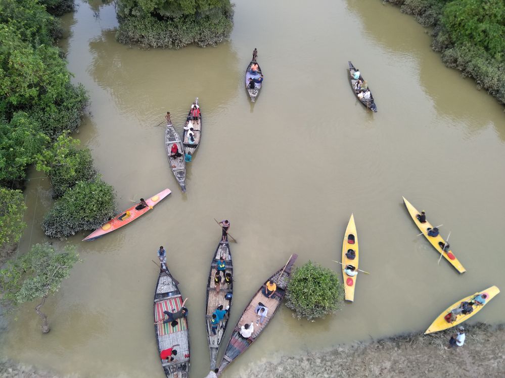
From the observation survey, it was found that every day more than one thousand tourists visit this area. But the forest is too little to bear this number of tourists every day. The local people commented that the following days and occasions are the peak time when tourists visit the forest in maximum.
- The weekend days (Saturday and Friday)
- Government holidays (single or multiple days holiday)
- Any kind of religious festival (Eid or Puja)
- The rainy season (from June to September)
According to the respondents, this excess number of tourists causing threats to biodiversity, the natural setup of the forest.

2.1.2 Floating Shop for the Tourist
On the basis of ecotourism law, there must be no harmful activities to the ecosystem and no intrusion of the local market in the ecotourism spot.
But in the observation survey, it was found that 2 floating shop is available there for the tourist. This shop is on a boat that moves across the waterbody whole day. But on the basis of the respondent’s opinion, about two-thirds of respondents opine that it may harmful for the forest in the future.
Because at this time the number of shops is two, it can be increased by years as the number of tourists is increasing by years tremendously.


The respondents in the group discussion also mention that this activity is forbidden in the forest. Few of the concerned authority is permitting to access the shops in the forest either seasonally or year-round. The respondents also commented that this activity is developed due to the tourist demand that is harmful to the forest.
2.1.3 Tourist activities in the forest
The observation survey found that tourists are not controlled in the forest. As there is no tourist guide, so the tourist goes through the forest wherever they want. This decreasing the sound place of the living place of the birds and snakes. According to local people’s opinion, the threatened activities by the tourist are given in the following figure according to their ranks and respondents’ opinion percentage.

Plastic Pollution of Ratargul Swamp Forest
Most of the foods consumed by the tourist are paced by plastic. It is the main source of plastic pollution in the forest. One respondent added that if only 100 plastic packets are added in the forest in a day, then it would be 36500 in a year and it will be 365000 after ten years.
It indicates that if each of the plastic packets would be half a square inch in the area then after 10 years one-fourth of the forest will be covered by plastic. But the reality is too much more severe. As there is no dumping zone, the collected plastic mixed with the water and soil with runoff water in the rainy season. In this season the tourists are maximum in this tourist spot.
The main types of plastics that found in the forest are:
- Chips packet
- Chocolate and chewing gum packs
- Plastic water bottles
- Polythene bags
- Soft drinks packets

Avoiding Eco-Tourism Rules
At this eco-tourism spot, the rules are not followed by the concerned authority. Few rules are initiated for the tourist and local people by the authority and USAID. But implementation rate is very low.

The local people opined that these rules are not followed by the tourist because the tourist is not too concerned about the rules. Besides this, the authority is not strict to push the tourist to follow the rules. Moreover, few boards are hampered with the local people works.
2.1.4 Disturbing the biodiversity
The presence of overloaded tourists all year round causing a serious impact on the biodiversity of the forest. The previous study suggests that this area contains a large number of biodiversity (both plants and animals).
From the last decade, it started to decrease. But in the last three years the number of aquatic animals, fish, snakes, birds, etc. has decreased at an alarming rate. According to the local people, in the winter season, the number of migratory birds had decreased tremendously in the last five years. During this time the ecotourism has developed in this area.

According to forest officials, once there were about 73 plant species, 20 species of reptiles, 26 species of mammals, and 175 species of birds in the forest. Locals said most of the species have already disappeared or become extinct due to the food crisis and loss of their habitats.
Cause of biodiversity loss
- Sound pollution in the forest
- Human movement in the forest all day long
- Food insecurity
- No biodiversity sanctuary
- Artificial lake
- Over-fishing
- Fish cultivation etc.
2.1.5 Tar mixing in the water
The boat is the main medium to travel in the forest. According to the local people, there are 150 boats at this moment that moves into the forest to carry the tourist. And another 37 boats will be added in this rainy season.
Most of these boats are constructed in the area of the forest. So, the tar used in the boat gets mixed with water. It has a direct impact on the water and the aquatic system that depend on it especially in the dry season.
- Changes to hydrology and aquatic habitat
- Changes to water quality
- Acidification of regional waterbodies
- Impacts of tailings

2.1.6 Controlling the water movement to develop tourism
According to the IUCN report in 2010 suggested that this swamp forest gets dried up in the late winter and pre-monsoon season.
In this condition different medicinal plants grow up. But the observation survey and satellite image from the Goggle Earth Pro suggests that this area (mainly the changing Khal) controlled by artificial embankment and dam. The canal also had been dug around the middle part of the forest to facilitate the boats in the dry season.
This activity has a direct impact on the total ecosystem. The key informants commented that it’s an anti-ecotourism activity and not sustainable for the forest. It has a direct immediately and long term impact on the forest ecosystem.


2.1.7 Construction Work
In the middle of the forest, a water tower has been constructed. Generally, the middle part of a forest is the safest zone for biodiversity. Because of its location, the tourist movement is maximum around the watchtower. It is impacting the natural beauty of the forest. Along with this, this tower is in the middle part of the Changer Khal that control and acts as a dam in the canal.

2.1.8 Road Construction
A road has been constructed at the boundary of the forest. This road permits cars to the starting points of the forest. The key informants and the local people are too much concerned and anxious about the impact of this road construction in the near future.

2.1.9 Duck ranching into the forest
The local people ranch thousands of ducks into the forest because it is a source of different kinds of food. Because of waterlogging most of the food goes underwater. the birds and other animals cannot access these foods. The authority is not concerned about this fact.

2.1.10 Fish Production using Fish-net
In the ecotourism spot, using fishnet a fish production project is an ongoing process in the middle of the forest. Eco-tourist spot acts as a sanctuary for the biodiversity which has a license for free movement. But this process violates the law. It is decreased the free movement of fishes into the forest.

From the above discussion, it can be concluded that within the five years the ecotourism has already created too many environmental issues. Both the local people and the environmentalists are too much worry about the future of the forest. Because tourism already has both the direct and indirect impact on the forest.
3.1 Proposed management approach to overcome existing problems
Ratargul Swamp Forest is regarded as a reserve forest. According to the definition of reserve forest (Forest Act, 1927), people have no right to do anything without permission (USAID, 2005).
However, the degradation of the forest is increasing day by day. There are several reasons for this disturbance including lacking the clear boundary, scarcity of surrounding people, encroachment, absence of implementation of existing law and policy, and other administrative problems.
In this case, the participatory forest management approach can be an effective tool to overcome the present problems of Ratargul Swamp Forest. Participatory forest management has become increasingly common in the last 25 years. It is known in different names in different countries such as community forestry, social forestry, adaptive co-management, community-based natural resource management, and so on (Shepherd, 1990).
Ratargul Swamp Forest is highly affected by local people. The structure of a participatory management approach must be implemented by the local community; national and international NGOs, research organizations, and forest departments.
Participation of local communities is important because they are better informed about the community forest, its history, evolution, and development. For sustainable management, local communities should be aware of the importance of swamp forests and have to find out alternative income sources. It is important to reduce pressure on swamp forests in terms of resource extraction and forest degradation.
To increase awareness, NGOs, forest departments, and other volunteer organizations should organize a workshop for local communities and forests depended on people. Moreover, it is needed to manage alternative income sources for poor local people by providing microcredit.
The alternative income sources could be poultry farming, business, and other jobs outside of the forest area. The forest department should be clearly defined as the forest boundary, must be maintained forest laws and policies.
Furthermore, the forest department has to address the endangered species and actual reasons behind forest degradation for rehabilitation. If these stakeholders i.e. the local communities, NGOs, forest departments, etc. work together, sustainable management is possible for this swamp forest.
It is found that participatory forestry management has covered 25% forest worldwide (White and Martin, 2002). Most of the countries of Africa and many countries of Asia are promoting a participatory approach to forest management (Wily, 2002).
Sometimes, a participatory management approach is challenging in resource sharing, nature conservation, and biodiversity management, because, local participants are not aware of the ecosystem (Leena, 2004).
Local communities always try to receive more resources within a short period. For instance, community people do not prefer long rotation species and they expect early returns to meet their daily needs. However, forestry plan makers try to have plantation with their preferable species.
In many countries, the participation of local people is quite challenging owing to the long tradition of top-down management approach and a strong bottom-up dependence on public provisioning (Atmisa, 2007).
Participatory based forest management is really a difficult task in terms of consistency, structuring, systematic planning, and analysis (Guillermo et al., 2015). At present integration of scientific methods with traditional knowledge is a new strategy to improve participatory forestry (Jun et al., 2009).
For instance, remote sensing (RS) and geographic information system (GIS) is an effective tool for multiple land use management planning relating to spatial context such as watershed areas, landslides areas, detect deforested places, identify community adjacent areas, etc. (Leman et al., 2015).
3.2 Conclusion
Bangladesh is considered as the largest delta in the world. The total wetland area of Bangladesh is estimated to be 70,000 to 80,000 km2. It comprises about 50% of the total national land of the country (Islam, 2010; Khan et al., 1994).
Therefore, wetland includes rivers, estuaries, mangrove swamp, freshwater swamp, marsh (haor), oxbow lake (baor), and Beel (bowl-shape depression), water storage reservoirs, ponds, and others seasonal inundation areas.
Wetlands in Bangladesh have a great contribution to the country’s ecological, industrial, socio-economic, and cultural aspects. About 50% of people of this country are directly dependent on wetland resources for livelihood (Islam, 2010) and 70% of animal protein of the country comes from freshwater fishes (Bhuiyan, 2013).
In addition to this, 6-8% of revenue comes from only haor areas of Bangladesh (BHWDB, 2012). However, wetlands of Bangladesh are being destroyed because of high population pressure and extreme level of resource extraction.
The results of the case study on Ratargul Swamp Forest found that the forest is located 35 m above from mean sea level. Physically this forest consists of parts of two rivers, several canals, a natural depression and artificial ponds.
However, the level of water in this forest varies in different seasons and periods. During the rainy season, the bank of rivers, canals, ponds, and natural depressions goes down underwater. But, in the dry season, the average depth of water in the rivers and canals is 3.5 m and 2 m respectively.
In the rainy season, the average height of the water level from the forest floor is 4 m. Sometimes it raises 7.5 m due to heavy rainfall and upstream flow. The water level plays a significant role in the appearance of plant species, the movement of aquatic and terrestrial animals.
The research found that four types of ecosystem functions exist in this swamp forest such as hydrological, biogeochemical, ecological, and atmospheric functions. The values and services are the results of these four types of functioning which include environmental, economic (including direct, indirect, option, existence, bequest values), social, and cultural values.
These services are playing a vital role in the local communities directing to livelihood security and to maintain environmental quality. The study also found that the maximum families of this area are very poor, poor, and middle-class types.
These families are involved with swamp forests for their income generation in different ways of provision such as agriculture; fishing; a collection of food, fodder, fuel, and medicinal plants, tourism and forest-related activities.
About 90% of very poor and poor households are dependent on the income from fishing and tourism activities in the rainy seasons. Moreover, 95% of these households are massively involved in fuelwood collection from this forest.
However, the swamp forest is being destroyed owing to high population pressure and extreme level of resource extraction. The 36 human-related disturbances are the extreme level of fishing, fuelwood collections, agricultural expansions, illegal felling, irrigation, grazing, agricultural land expansion, infrastructure, human habitat, tourism activities, illegal hunting of medicinal plants and other non-timber forest products, use of pesticides and other activities.
The climate change impact includes irregular and heavy rainfall, flood, flash flood, storm, siltation, etc. For this consequence, the water-body decreased by 4 ha from 2005 to 2015 (total area 208 ha). This study also found that the total area of the high-density forest was 114.80 ha in 2005 whereas in 2015 it was 96.40 ha.
It has reduced by 18.40 ha within 10 years. The degraded area has increased by 25.53 ha from 2005 to 2015. A remarkable change is found in the middle of the forest where there was no degradation in 2005. But in 2015, the degraded area was significant for making artificial ponds.
About 94 species of fish inhabit in the Ratargul Swamp Forest where 28 species are now threatened, 14 are vulnerable, 10 are endangered and 4 are critically endangered (Islam et al., 2016).
There are several reasons for these disturbances including lack of clear boundary, scarcity of surrounding people, encroachment, absence of implementation of existing law and policy, and other administrative problems.
However, the participatory forest management approach (working together with the local community, forest department, national and international NGOs, research organizations, and other volunteer organizations) could be an effective tool to overcome existing problems of Ratargul Ecotourism Spot.
4. References
- Angela, M. G., Walter, B., Dov, C., (2012). Changing river channels: the role of hydrological processes, plant, and pioneer fluvial landforms in humid temperature, mixed load gravel rivers. Earth Science Review,
- Atma, E., SezginOzdenb, S., Lisec, W., (2007). Public participation in forestry in Turkey. Ecological Economics,
- Bhuiyan, M.R., (2013). Wetland management of Bangladesh: a sustainable bio diversified approach. Dhaka, Bangladesh: Nature Study Society of Bangladesh.
- Choudhury, J. K., Biswas, S. R., Islam, M. S., Rahman, O. and Uddin, S. N. (2004). Biodiversity of Ratargul swamp forest, Sylhet. Dhaka, Bangladesh: IUCN Bangladesh Country Office.
- Choudhury, J., Shekhar, R., Sazedul, I., Rahman, O., Sarder, N.U., (2004). Biodiversity of Ratargul swamp forest, Sylhet. Sylhet, Bangladesh: IUCN the world conservation union Bangladesh office.
- Groot, R.S., (1992). Functions of Nature: Evaluation of Nature in Environmental Planning, Management and Decision Making. Wolters-Noordhoff: Groningen
- Islam, M. S., Islam, M. A., Sweety, N. A., Hossain, M. A. R. and Kabir, M. H. (2016). Assessment of aquatic faunal diversity in the Ratargul swamp forest at Sylhet in Bangladesh. Journal of Environmental Science and Natural Resources, 9(2),.
- Islam, M.A., Islam, M.J., Arefin, S., Rashid, A., Barman, S.K., (2016). Factors affecting the fisheries biodiversity of Ratargul swamp forest of Sylhet district, Bangladesh. IOSR Journal of Environmental Science, Toxicology and Food Technology (IOSR-JESTFT), 10(1):.
- Islam, S.N., (2010). Threatened wetlands and ecologically sensitive ecosystems management in Bangladesh, Front. Earth Sci. China, 4(4):.
- IUCN., 2004. Biodiversity of Ratargul Swamp Forest, Sylhet, Bangladesh.
- Kanan, H. A. (2016). Characterization and conservation of wetlands with global change dynamics: a case study on Ratargul Swamp Forest, Bangladesh, LISBOA.
- Lamsal, P., Pant, K.P., Kumar, L., Atreya K. (2015). Sustainable livelihoods through conservation of wetland resources: a case of economic benefits from Ghodaghodi Lake, western Nepal. Ecology and Society,
- Leena, A., Leskinen., (2004). Purposes and challenges of public participation in regional and local forestry in Finland. Forest Policy and Economics, 6,.
- Leman, N., Ramlia, M. F., Khirotdinb, K., (2015). GIS-based integrated evaluation of environmentally sensitive areas (ESAs) for land use planning in Langkawi, Malaysia. Ecological Indicators, .
- Opio, A., Lukale, J.K., Masaba, I.S., Oryema, C. (2011). Socioeconomic benefits and pollution levels of water resources, Pece wetland, Gulu Municipality – Uganda. African Journal of Environmental Science and Technology, 5(7).


