
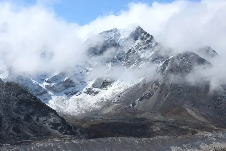
The catastrophic flash flood that struck the Nepal–Tibet border on 26 August is more than a Himalayan disaster. Bangladesh lies downstream of important Himalayan rivers, highlighting how water and climate issues can cross national borders. Early satellite analysis indicates that a substantial section of glacier and underlying rock collapsed at high elevation.
This triggered an ice–rock avalanche and debris flow into the Lhende Khola. The resulting surge travelled downstream through the Bhote Koshi and Trishuli river systems. As a result, river levels reportedly rose by as much as nine meters within just 30 minutes.
What makes the event particularly important from a climate perspective is the chain of hazards involved. A warming climate does not simply mean that glaciers melt and rivers receive more water.
Rising temperatures can also affect the stability of glaciers, snowpack’s, permafrost, and the rock–ice systems that hold steep mountain slopes together. As these components become less stable, one hazard can trigger another.
For Nepal, the chain of events was:
Glacier collapse → landslide → temporary river blockage → sudden flood → debris flow.
However, it is important not to oversimplify the science by saying that climate change directly caused this particular disaster. Scientists are still investigating the precise contribution of warming, glacier conditions, snowmelt, and geological factors.
What is becoming increasingly clear is that a warming Himalaya is creating a more complex high-mountain hazard environment. There are growing concerns around glacier instability, landslides, debris flows, and related floods.
So where does Bangladesh come in? Bangladesh sits at the downstream end of the Ganges–Brahmaputra–Meghna (GBM) basin, one of the world’s major transboundary river systems. Much of Bangladesh’s water system is therefore connected to processes occurring hundreds or even thousands of kilometers upstream.
This does not mean that a glacier collapse in Nepal will simply produce a flood in Bangladesh. The Lhende–Bhote Koshi–Trishuli system ultimately feeds the Gandak rather than directly flowing into Bangladesh. But the broader lesson is about basin-level vulnerability.
The Himalayas are often described as the water tower of South Asia. Changes in snow, glaciers, rain, sediment flow, and heavy river flow can affect water availability, river shape, and flood risk in connected areas.
Recent studies on the GBM basin show that climate change has made river flows higher in all seasons and has raised the likelihood of severe flooding at key river points in Bangladesh.
For Bangladesh, climate adaptation therefore cannot be viewed solely through the lens of rainfall within Bangladesh’s borders.
Bangladesh has to deal with both flood management and transboundary climate-risk management. We have long invested in embankments, drainage, flood forecasting, and early-warning systems. But a changing climate demands a broader approach.
We need to improve how we share data from upstream to downstream. This means getting real-time river flow, rain, glacier and snow updates, satellite tracking, and information on dangers at high altitudes.
There is also a need to strengthen basin-scale hydrological modelling. Instead of asking only, ‘How much rain will Bangladesh receive?’, we now need to ask: ‘What is happening across the entire river basin before that water reaches Bangladesh?’
That means connecting cryosphere science with hydrology, geomorphology, disaster-risk reduction, and climate adaptation. The recent disaster also highlights a limitation of conventional early-warning systems. A rainfall-based flood warning may provide hours or days of preparation.
But a sudden glacier or rock–ice collapse can generate a destructive flood within minutes. This needs a new type of early-warning system that uses satellites, checks for earthquakes, monitors rivers, uses remote sensing, models water flow, and communicates quickly.
So, what is the bigger lesson from Nepal? The Nepal disaster should not be viewed simply as another devastating flood in a distant mountain country. It is a glimpse into what a warming and increasingly unstable high-mountain environment could mean for an entire region.
For Bangladesh, perhaps the most important lesson is ‘Our climate vulnerability does not begin at our border.’ It begins much farther upstream, in the glaciers, mountains, rivers, and ecosystems that ultimately connect to our delta.
As climate change accelerates, adaptation must become increasingly transboundary, basin-based, and science-driven.
The Himalayas may be geographically distant from Bangladesh. However, hydrologically, they are not.
References:
- Reuters. (2026, August 26). Glacier collapse may have triggered deadly Nepal flash flood, experts say.
- Associated Press. (2026, August 27). Nepal floods highlight growing glacier risks in the warming Himalayas.
- Uddin, S., Yamazaki, D., Lintern, A., Revel, M., & Modi, P. (2025). Climate change and ENSO significantly enhance seasonal flood occurrence in the Ganges–Brahmaputra–Meghna basin. Journal of Hydrology, 658, 133207.